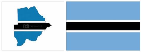
Botswana
Botswana – Southern Africa
Botswana is a state in Africa. The capital of the country is Gaborone. Approx. 2.3 million Botswanans and residents of other nationalities live in Botswana, making Botswana one of the most sparsely populated regions in the world. The official language is English. Botswana covers an area of around 582,000 km² and is therefore slightly larger than France. Neighboring countries are South Africa, Zimbabwe and Namibia.
Like the population, transport resources are concentrated to the eastern parts. In 2009, the road network covered 25,800 km. The main asphalt road goes from Gaborone via Francistown to Kazungula in the border area between Botswana, Namibia, Zambia and Zimbabwe.
The main railway is the track that cuts through 888 km through Botswana on the Mafikeng (South Africa) –Bulawayo (Zimbabwe) route. International airport is located in Gaborone, and other major airports are in Kasane, Francistown and Maun.
Lesotho
The mountainous terrain in Lesotho has meant that much of the country was accessible only by horse transport or by light aircraft. Lesotho is therefore heavily dependent on the road and rail networks in South Africa. However, several road construction projects and the construction of a network of easier roads for off-road vehicles have improved the situation. In total, there are 7 100 km of road in the country, of which about 800 km are paved. In Maseru there has been an international airport since 1986, and from Maseru 3 km goes by rail which connects the city with a railway line in Marseille, South Africa.
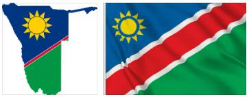
Namibia
Namibia – Southern Africa
Namibia is a state in Africa. The capital of the country is Windhoek. About 2.5 million Namibians, Namibians of other nationalities, live in Namibia, making Namibia one of the most sparsely populated regions in the world. The official language is English. Namibia covers an area of around 824,000 km² and is therefore around twice the size of Germany. Neighboring countries are South Africa, Angola, Zambia and Botswana.
Namibia’s transport network is strongly oriented towards South Africa. The most important railway runs from Nakop at the border with South Africa to Windhoek and then on to Walvis Bay. In the country there are approximately 2 600 km of narrow gauge railway with a gauge of 1,065 mm (so-called Cape gauge). The road network in 2010 consisted of 44 100 km of roads.
The country’s only deep port is in Walvis Bay and handles almost half of Namibia’s foreign trade. Another port is located in Lüderitz in the south. The airport in Windhoek is the only one that is classified as international.
Swaziland
Swaziland – Southern Africa
Swaziland is a state in Africa. The capital of the country is Mbabane. Around 1.4 million Swazi and residents of other nationalities live in Swaziland. The official languages are Siswati and English. Swaziland covers an area of around 17,000 km² and is thus about seven times the size of Luxembourg. Neighboring countries are South Africa and Mozambique.

Since independence, the transport and communication networks have been expanded, tied with other Swedish assistance. In 2009, Swaziland had approximately 3,600 km of roads, of which 25 per cent paved. Swaziland’s first railway was the completed 225 km eastbound route from Ngwenya to the port of Maputo, Mozambique in 1964. In 1978, it was linked by a 93 km southbound line to the South African port city of Richards Bay. Finally, in 1986, a northbound line was opened to Komatipoort in South Africa, whereby northeastern South Africa via Swaziland was given a direct connection to Richards Bay and Durban. From the Matsapa International Airport, Royal Swazi Airways began flights to South Africa in 1978.
South Africa
South Africa’s transport and communication networks are well developed and are the most advanced among all African countries according to Countryaah. In 2014, the road network comprised 747,000 km, of which one quarter was permanently covered. The railway network, which is narrow-gauge (1,067 mm), covered 21,000 km at the same time.
South Africa has no navigable rivers, but shipping between the country’s port cities is important. The major ports (Durban, Cape Town, Port Elizabeth and East London) also provide significant transit traffic to and from Botswana, Zimbabwe, Zambia, Southern Congo (Kinshasa) and Malawi. The port of Saldanha Bay is the largest on the west coast of Africa.
Air traffic plays a prominent role. It was deregulated in the early 1990’s, and in addition to the state-owned South African Airways, there are several private companies with traffic on domestic lines. The airports in Johannesburg, Cape Town and Durban serve international traffic.

South Africa – Southern Africa
South Africa, the rainbow nation, is a state in Africa. The capital is Pretoria. Around 49 million South Africans and people of other nationalities live in South Africa. The official languages are Zulu, Xhosa, Afrikaans, Sepedi, English, Tswana, Sesotho, Tsonga, Swati, Venda and Ndebele. South Africa covers an area of around 1 million km² and is about four times the size of Italy. The highest mountain in South Africa is the Mafadi at 3,450 meters. Neighboring countries are Mozambique, Zimbabwe, Namibia, Botswana, Lesotho and Swaziland.
The national holiday of South Africa is April 27th (day of the first free elections on Freedom Day in 1994).
Provinces in South Africa
Free State Province – South Africa
Free State is in South Africa. Around 2.7 million people live in the Free State on an area of around 130,000 km². The capital is Bloemfontein.
Gauteng Province – South Africa
Gauteng is located in South Africa. About 12 million people live in Gauteng on an area of around 18,000 km². The capital is Johannesburg.
KwaZulu-Natal Province – South Africa
KwaZulu-Natal is in South Africa. Around 10 million people live in KwaZulu-Natal on an area of around 94,000 km². The capital is Pietermaritzburg.
Mpumalanga Province – South Africa
Mpumalanga is located in South Africa. About 4.0 million people live in Mpumalanga on an area of around 76,000 km². The capital is Mbombela.
Northwest Province – South Africa
Northwest is in South Africa. Around 3.5 million people live in the northwest on an area of around 105,000 km². The capital is Mahikeng.
Eastern Cape Province – South Africa
Eastern Cape is in South Africa. Around 6.6 million people live in the Eastern Cape on an area of around 169,000 km². The capital is Bhisho.
Western Cape Province – South Africa
Western Cape is in South Africa. About 5.8 million people live in the Western Cape on an area of around 129,000 km². The capital is Cape Town.
Cities in South Africa
Durban – KwaZulu-Natal
Durban is a South African city in KwaZulu-Natal with a population of around 3.3 million. The urban area covers an area of around 2,290 km².
Johannesburg – Gauteng
Johannesburg is a South African metropolis in Gauteng with around 4.4 million residents. The urban area covers an area of around 1,650 km². In the area is about 55 km away Pretoria.
Cape Town – Western Cape
Cape Town is a South African metropolis in the Western Cape with around 3.7 million residents. The urban area extends over an area of around 2,460 km².
Pretoria – Gauteng
Pretoria is a South African city in Gauteng with around 740,000 residents. The urban area extends over an area of around 1,640 km². In the area is about 55 km away Johannesburg.