Italy lies between 35 ° 29ʹ ( Lampedusa ) and 47 ° 05ʹ north latitude, and between 6 ° 33ʹ and 18 ° 30ʹ east longitude. The border to the north with Switzerland and Austria follows largely the watershed between Po and the Danube. In the west, the border with France mainly follows the watershed between Po and Rhone.
The border with Slovenia was established following a referendum after the Second World War and does not follow any natural boundary lines. The sea border is formed by the Ligurian Sea, the Bonifacio Strait, the Tyrrhenian Sea, the Sicily Sea, the Ionian Sea, the Otranto Strait and the Adriatic Sea.
Geology
Italy is geologically a relatively young country, formed during the alpine mountain range that took place in the tertiary between 70 and 10 million years ago. Both the Alps and the Appennines belong to this folding mountain system. After the folds, the country has been exposed to vertical shifts, including periods of subsidence. These offsets have largely occurred along fracture lines, where there was already a considerable volcanic activity already in the Tertiary period. An earthquake still occurs (an earthquake killed more than 3,000 people southeast of Naples in November 1980), and Mount Vesuvius, Etna and Aeolian Islands is one of the most active volcanic regions in Europe.
The geological development has led to the formation of a number of natural landscapes or small regions, which can be divided into three main areas: the Alps, Posletta and the Appennines, as well as the islands of Sicily and Sardinia.
Alps
Within Italy’s borders are found almost the entire inside of the alpine arch, including parts of the Western Alps, the Central Alps and the Eastern Alps. The Western Alps rise like a wall from Posletta and consist mainly of crystalline rocks. The valleys here are very short or almost completely missing. The highest parts are the Greek Alps (Gran Paradiso 4061 meters above sea level), the Mont Blanc massif, which in Italy rises to 4700 meters above sea level, and the Wallis alps (Alpi pennine) with Monte Rosa (4634 meters above sea level) and Monte Cervino ( German Matterhorn, 4478 meters above sea level) on the border with Switzerland. The Central Alps consist of powerful strata of Mesozoic and Tertiary limestones, reaching into the Rätian Alpsover 4000 meters (Piz Bernina 4049 meters above sea level). Here the ice has excavated a number of north-south valleys, today partially filled by lakes: Lake Maggiore, Lake Como, Lake Iseo and Lake Garda. These, at the southern end, are dammed by large moraine ridges, are deep and have a great influence on the local climate.
Further east, the Alps eventually pass into the Dolomites, which consist of heavily folded limestone deposits. The highest reaches of Marmolada (3342 meters above sea level). At the far east, the border with Austria is formed by the Karnian Alps. The entire alpine area is strongly shaped by the ice with pointed peaks, bottoms and eggs. A number of deep valleys lead up to pass over the watershed. For example, Dora Riparia leads up to Mont Cenis Pass (2082 meters above sea level), Dora Baltea up to Lille (2188 meters above sea level) and Store (2472 meters above sea level) St. Bernhard Passes, Ticino Valley to St. Gotthard Pass (1154 meters above sea level) and the Adige valley to the Brenner Pass (1370 meters above sea level).
Po Valley
Posletta is a subsidence area ( geosynclinic ) between the Alps and the Appennines filled with late tertiary and quaternary, up to 10 kilometers thick sediments, and was previously a shallow sea bay. Sletta, which in Italian is called Pianura Padana, covers an area of 46,000 square kilometers and is over 320 kilometers long and up to 200 kilometers wide. The upper parts (Alta Pianura) consist of gravel and sand deposits, the lower parts (Bassa Pianura) of clay. The gravel-sand plains are very water-permeable and therefore dry, so that irrigation must be used in great style, but the rainwater breaks out again in a source zone where the upper and lower parts of the plain meet.
The rivers from the Alps have cut the upper part of the plain into a number of separate plateaus. They unite in Po (652 kilometers long), which extends into the Adriatic into a large delta, where sand, gravel and clay particles are sedimented. To the west of Padova, two extinct volcanoes rise over the plain: Monti Berici (421 meters above sea level) and Colli Euganei (603 meters above sea level).
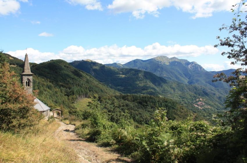
Apennines
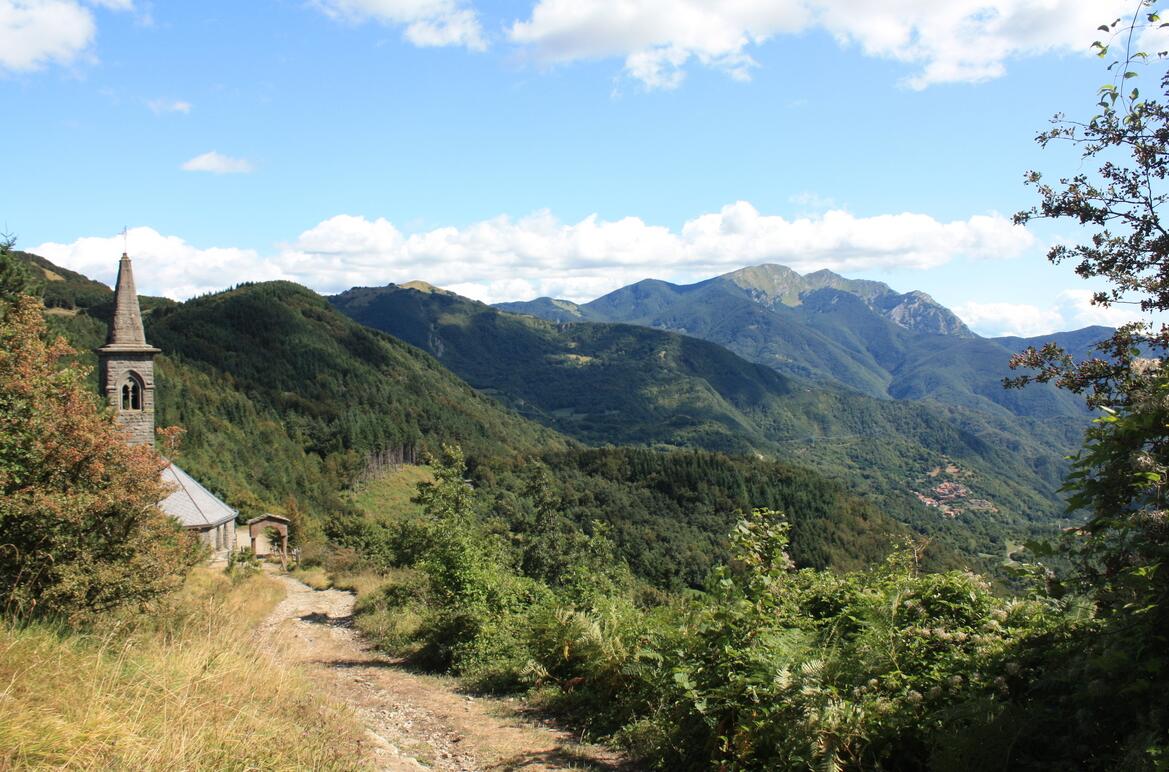
Apennines. From Passo della Cisa on the border between Tuscany and Emilia-Romagna.
The Apennines, which extend along the entire peninsula and continue along the north coast of Sicily, are made up of Mesozoic and Tertiary limestones and clay slates, which were folded into tertiary. The height varies mostly between 750 and 1800 meters, with the main chain closest to the Adriatic Sea. All the way north, at Savona, the Appennines cross into the Ligurian Alps on the border with France. These mountains are called Ligurian Appennines, and are easy to pass at Genoa (Passo dei Giovi, 472 meters above sea level). East of the Taro River follows the Tuscan Appennines with Monte Cimone (2165 meters above sea level) as the highest point.
To the west of the Tuscan Appennines is a small mountain area, Apuan Appennines, which consists of transformed sediments, including the famous marble at Carrara. Monte Pisanino (1946 meters above sea level) is the highest point in this group. At the Bocca Serriola pass, Tuscan Appennines turn into Roman Appennines, which consist of several parallel chains made up of limestone. The highest is Abruzzi, which reaches 2912 meters above sea level on the Gran Sasso d’Italia (Corno Grande), the highest mountain in the Italian peninsula. To the west of the main chain are lower parallel chains in Umbria and the Sabiner mountains, which reach all the way down to Rome. Neapolitan Appennines begin south of a line fromGaeta to the Adriatic. The chain bends away from the Adriatic Sea and approaches the Tyrrhenian Sea, as it reaches south of Naples. The mountains reach their highest point in the Serra Dolcedorme (Pollino, 2267 meters above sea level) in Calabria.
The Apennines’ western foreland extends from La Spezia in the north to the south of Naples. Almost everywhere there is a low coastal plain with dunes and shores, and behind these often swampy fields. The northern part of Tuscany, around the river Arno, is a hilly country. The highest point here is Monte San Michele (893 meters above sea level). Further south, the landscape is strongly characterized by volcanic activity. The highlands between Monte Amiata (1738 meters above sea level) in southern Tuscany and the Albanian mountains south of Rome are of volcanic origin. The lakes of Bolsena, Vico, Bracciano, Albano and Nemi lie in the craters of extinct volcanoes. Also the scenic fields north of the Gulf of Naples and the islands of Ischia, Procida and Ponza are volcanic. Mount Vesuvius (1277 meters above sea level), Italy’s most famous volcano, dominates the Gulf of Naples. To the southeast, on the “heel” of the Italian peninsula, the Appennines are separated from the isolated Monte Gargano (1056 meters above sea level) on the “track” of the low limestone plateau of Puglia.
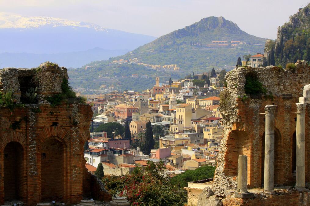
Sicily: Taormina with parts of the ancient Greek amphitheater. In the background to the left volcano Etna.
Sicily
Sicily, like the Italian peninsula, consists mostly of mountain and hinterland. The mountains along the north coast are a continuation of the Appennines, and consist alternately of limestone, clay, sandstone and crystalline rocks. The mountains continue to the west in the Egyptian islands.
Etna (3323 meters above sea level) is Europe’s highest active volcano and covers an area of about 1200 square kilometers. The Aeolian islands north of Sicily, including Vulcano and Stromboli, are all volcanic. Ustica, further west, is an isolated volcanic island. In the Strait between Sicily and Tunisia are three Italian islands: Pantelleria, Linosa and Lampedusa. The first two are volcanic, the latter consisting of limestone.
Sardinia
Sardinia is for the most part composed of crystalline rocks of much older date than the rest of Italy. A massive block covers the island’s eastern two-thirds. This is separated from the smaller Iglesian massif at the Campidanol catchment. The island’s highest point is Gennargentu (La Marmora, 1834 meters above sea level).